 |
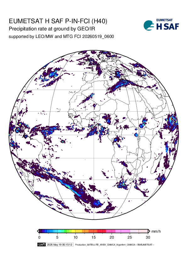
H40B P-IN-FCI Precipitation rate at ground by blended MTG FCI IR / LEO MW precipitation (day-1 product) operational Available in 0.5 hours
| ||||||||
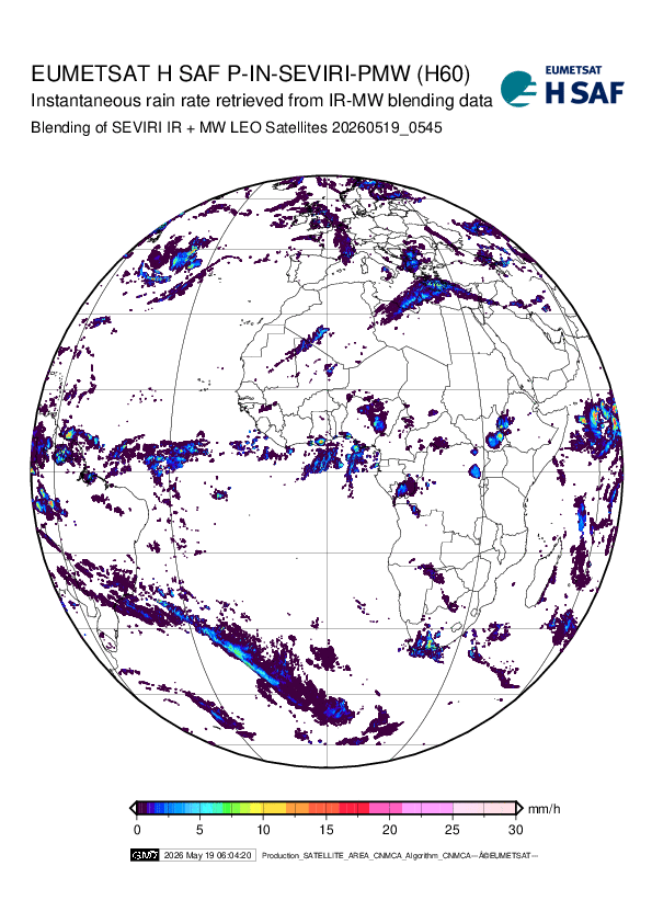 |
H60B P-IN-SEVIRI-PMW Precipitation rate at ground by blended SEVIRI IR / LEO MW precipitation and morphologic information operational Available in 0.5 hours
| ||||||||
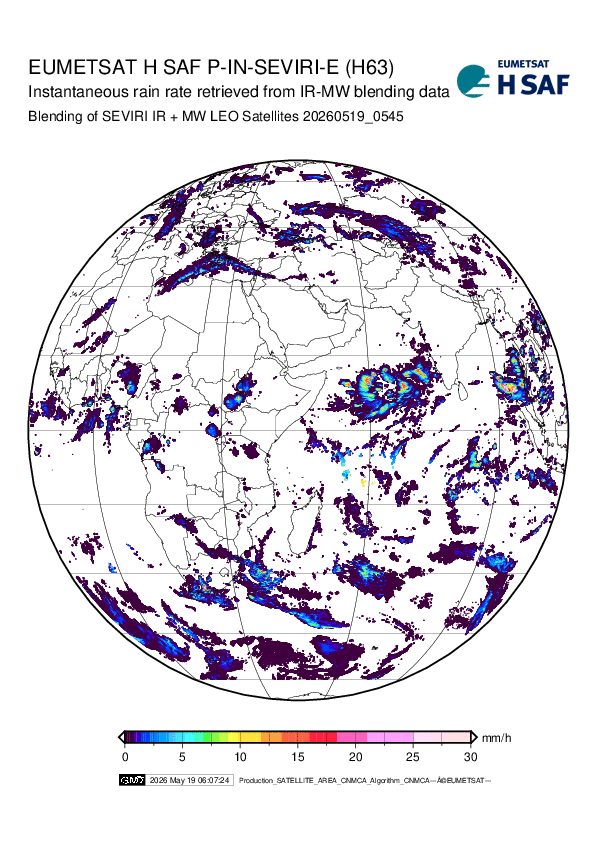 |
H63 P-IN-SEVIRI_E Precipitation rate at ground by GEO/IR supported by LEO/MW IODC operational Available in 0.5 hours
| ||||||||
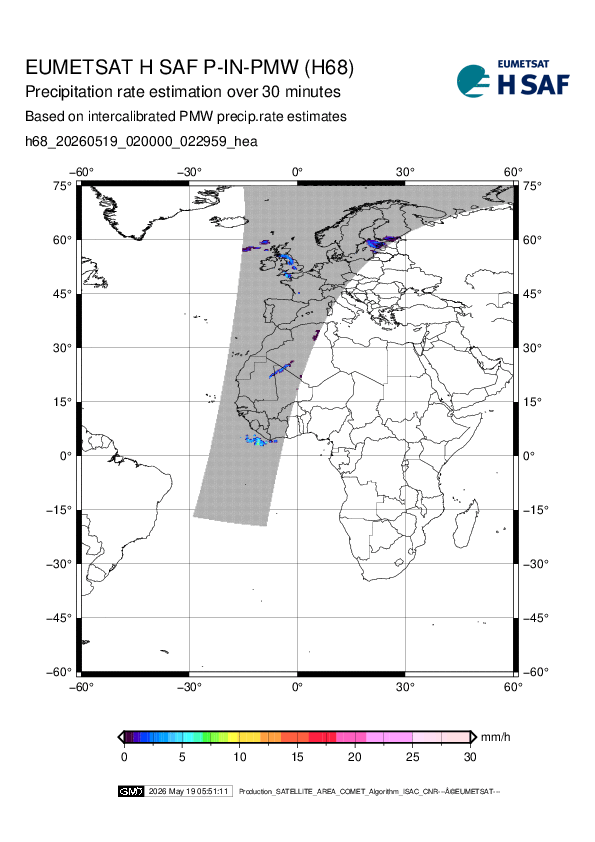 |
H68 P-IN-PMW Gridded MW instantaneous precipitation rate based on ntercalibrated PMW instantaneous precipitation rate estimates operational Available in 4 hours
| ||||||||
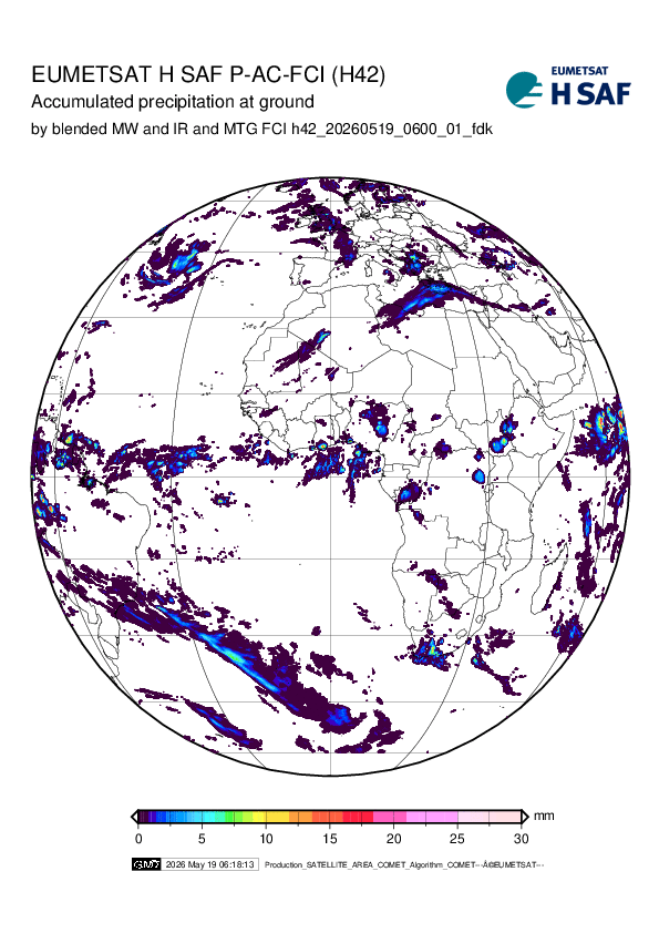 |
H42B P-AC-FCI Accumulated precipitation at ground by blended MTG FCI IR / LEO MW precipitation (day-1 product) operational Available in 0.5 hours
| ||||||||
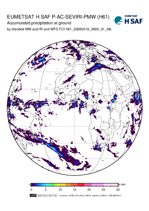 |
H61B P-AC-SEVIRI-PMW Accumulated Precipitation at ground by blended SEVIRI IR / LEO MW precipitation and morphologic information operational Available in 0.5 hours
| ||||||||
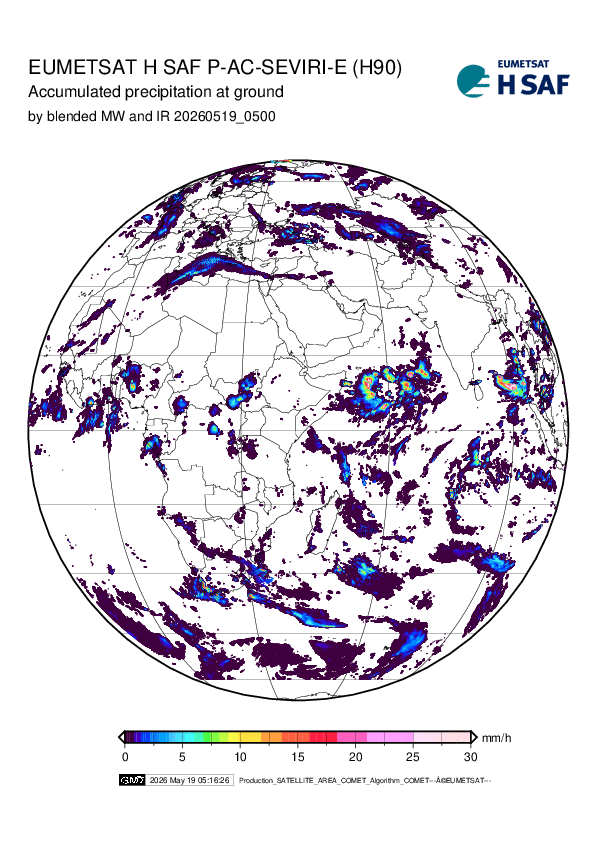 |
H90 P-AC-SEVIRI_E Accumulated Precipitation at ground by blended MW and IR IODC operational Available in 0.5 hours
| ||||||||
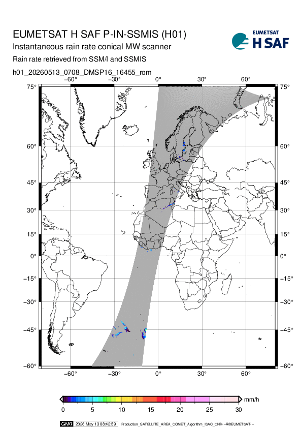 |
H01 P-IN-SSMIS Precipitation rate at ground by MW conical scanners SSMIS operational Available in 4 hours
| ||||||||
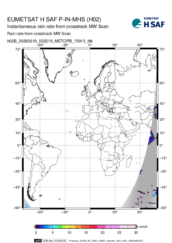 |
H02B P-IN-MHS Precipitation rate at ground by MW cross-track scanners AMSU/MHS operational Available in 4 hours
| ||||||||
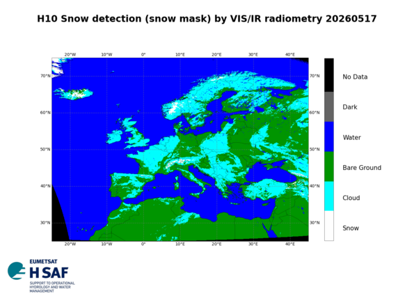 |
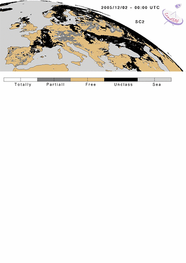
H10 SE-E-SEVIRI Snow detection (snow mask) by VIS/IR radiometry operational Available in 3 hours
| ||||||||
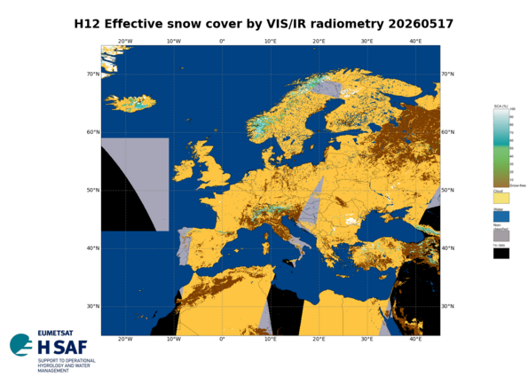 |
H12 E SC-E Effective snow cover by VIS/IR radiometry operational Available in 3 hours
| ||||||||
 |
H122 ASCAT SSM NRT 6.25 km Metop ASCAT Surface Soil Moisture NRT 6.25 km sampling operational Available in hours
| ||||||||
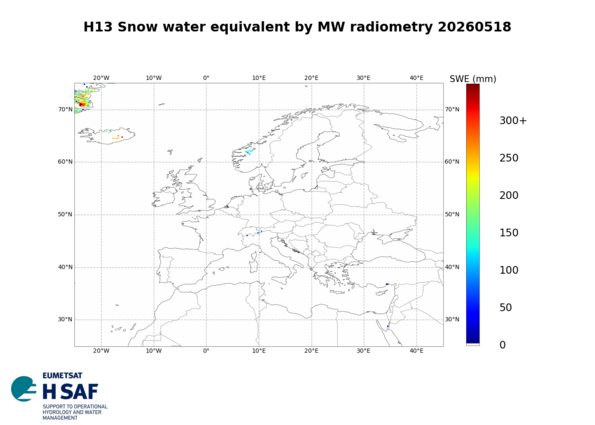 |
H13 SWE-E Snow water equivalent by MW radiometry operational Available in 6 hours
| ||||||||
 |
H14 SM-DAS-2 Soil Wetness Profile Index in the roots region retrieved by Metop ASCAT surface wetness scatterometer assimilation method operational Available in 12 hours
| ||||||||
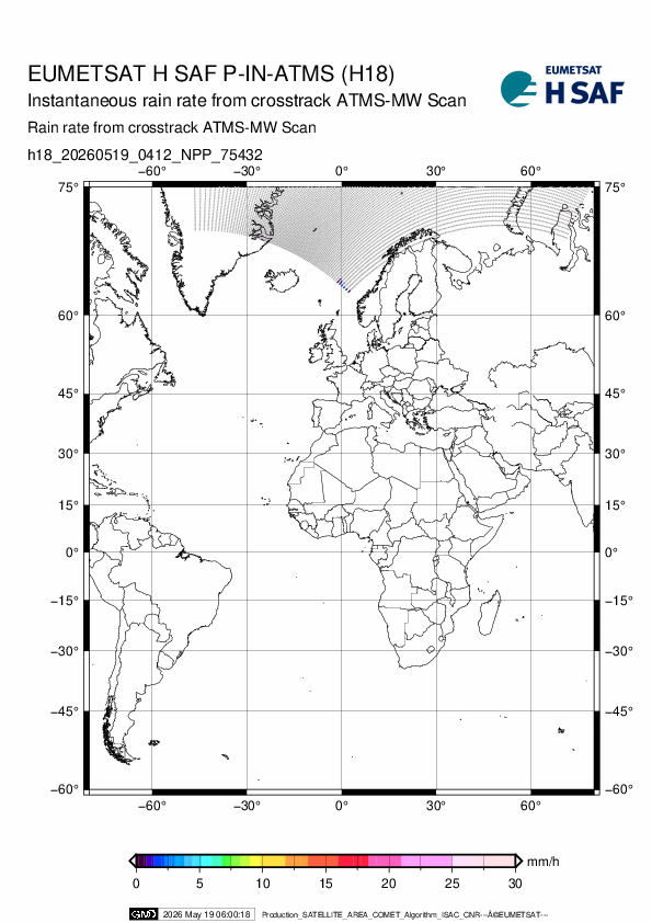 |
H18 P-IN-ATMS Precipitation rate at ground by MW cross-track scanners ATMS operational Available in 4 hours
| ||||||||
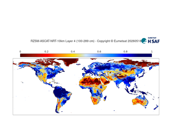 |
H26 RZSM-ASCAT-NRT-10 Metop ASCAT NRT Root Zone Soil Moisture Profile Index 10km resolution operational Available in 12 hours
| ||||||||
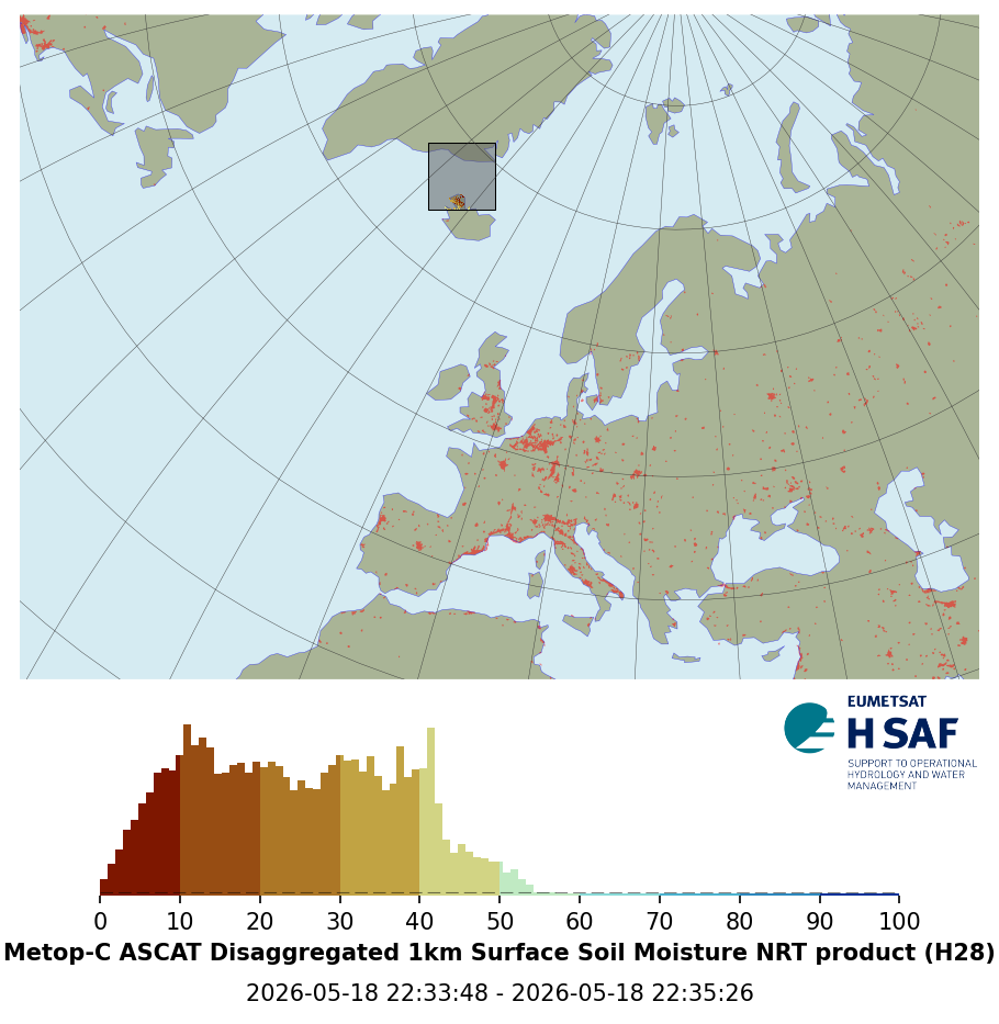 |
H28 ASCAT-DIS-SSM-NRT Disaggregated Metop ASCAT NRT SSM (Version 2) operational Available in hours
| ||||||||
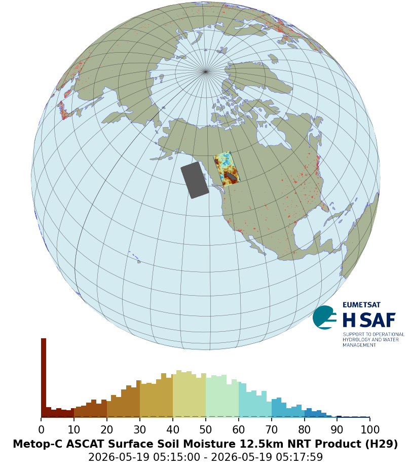 |
H29 ASCAT SSM NRT 12.5 km v2 Metop ASCAT Surface Soil Moisture Near Real-Time 12.5 km sampling V2 operational Available in hours
| ||||||||
 |
H31 SE-D-SEVIRI-F Snow detection for flat land (snow mask) by VIS/NIR of SEVIRI operational Available in 3 hours
| ||||||||
 |
H32 SE-G-AVHRR Snow detection for flat land (snow mask) by VIS/NIR of AVHRR operational Available in 3 hours
| ||||||||
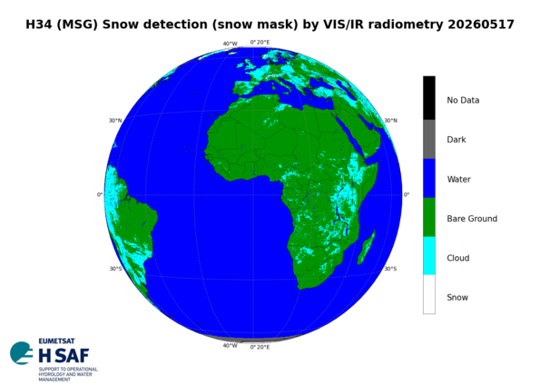 |
H34 SE-D-SEVIRI Snow detection (snow mask) by VIS/IR radiometry operational Available in 3 hours
| ||||||||
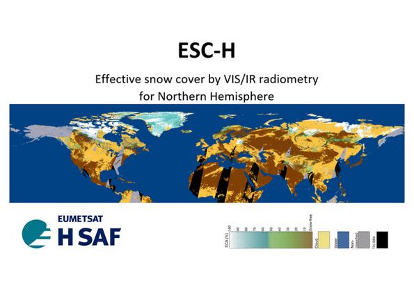 |
H35 ESC-H Effective snow cover by VIS/IR radiometry operational Available in 3 hours
| ||||||||
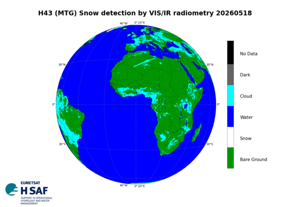 |
H43 SE-D-FCI Snow detection (snow mask) by VIS/NIR of MTG FCI operational Available in 4 hours
| ||||||||
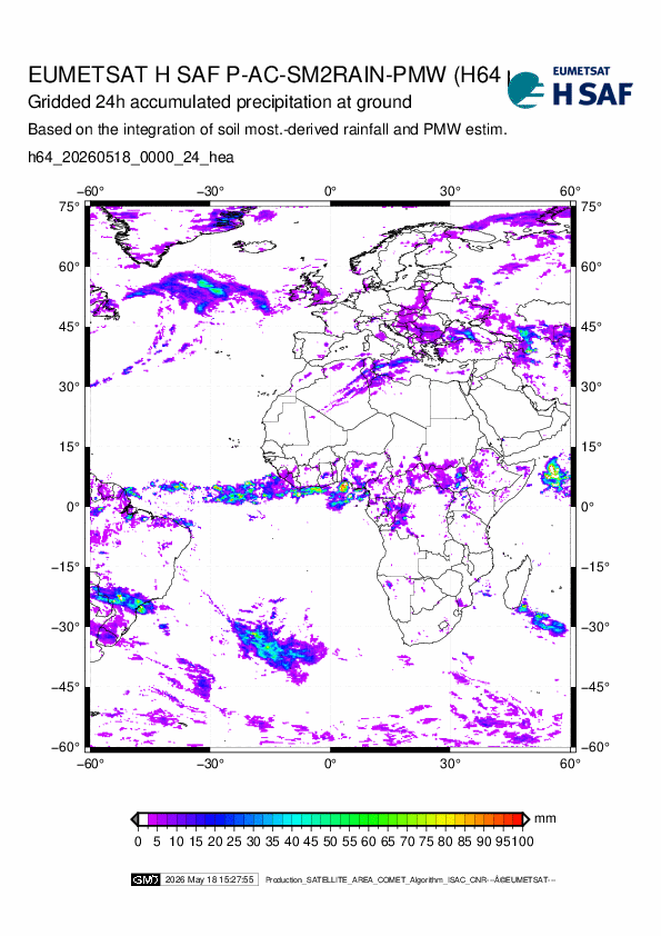 |
H64 P-AC-SM2RAIN Accumulated Precipitation from PassiveMicrowave/Soil Moisture integrated rainfall product operational Available in 15 hours
| ||||||||
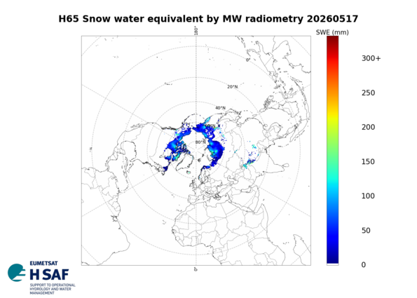 |
H65 SN-SWE-HH New Global (hemispherical) SWE 25 km resolution operational Available in 4 hours
| ||||||||
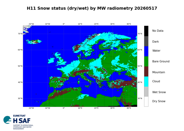 |
H11 WS-E Snow status (dry/wet) by MW radiometry pre-operational Available in 3 hours
| ||||||||
 |
H03B P-IN-SEVIRI discontinued
| ||||||||
 |
H05B P-AC-SEVIRI discontinued
| ||||||||
 |
H101 SSM-ASCAT-A-NRT-O12.5 discontinued
| ||||||||
 |
H102 SSM-ASCAT-A-NRT-O25 discontinued
| ||||||||
 |
H103 SSM-ASCAT-B-NRT-O25 Metop-B ASCAT NRT SSM orbit geometry 25 km sampling discontinued
| ||||||||
 |
H104 SSM ASCAT-C NRT O12.5 Metop-C ASCAT NRT SSM 12.5 km sampling discontinued
| ||||||||
 |
H105 SSM ASCAT-C NRT O25 Metop-C ASCAT NRT SSM 25 km sampling discontinued
| ||||||||
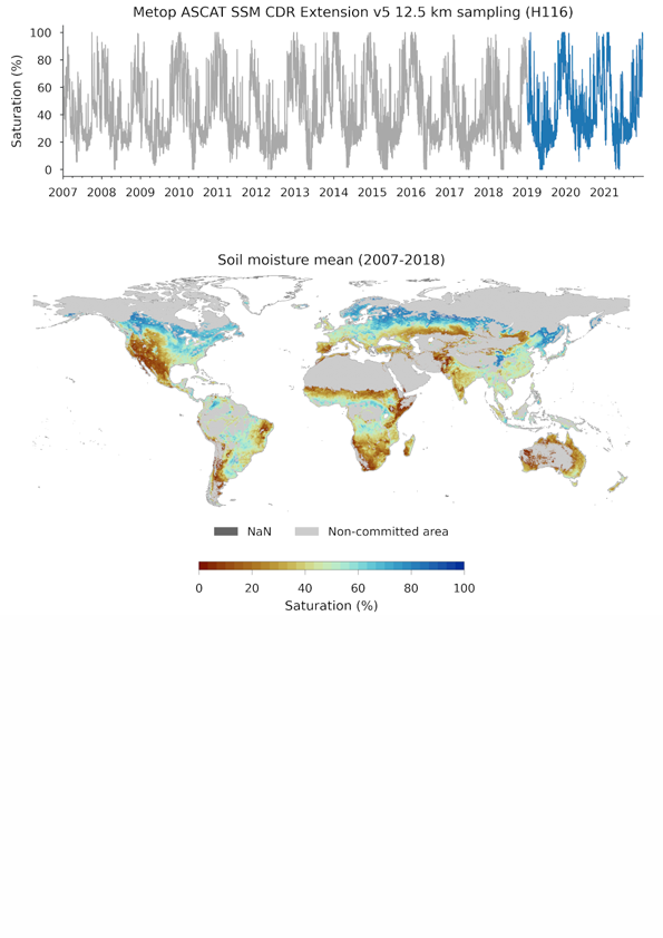 |
H116 ASCAT SSM CDR v5 EXT 12.5 km discontinued
| ||||||||
 |
H15 P-IN-SEVIRI-CO discontinued
| ||||||||
 |
H16 SSM-ASCAT-B-NRT-O12.5 Metop-B ASCAT NRT SSM orbit geometry 12.5 km sampling discontinued
| ||||||||
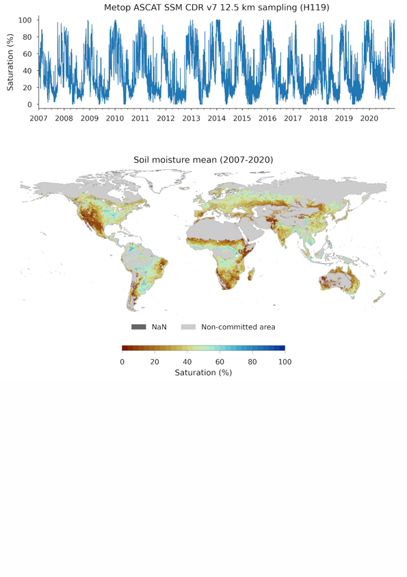 |
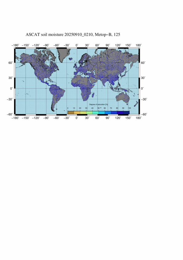
H119 ASCAT SSM CDR v7 12.5 km Metop ASCAT Surface Soil Moisture Climate Data Record v6 12.5 km sampling released
| ||||||||
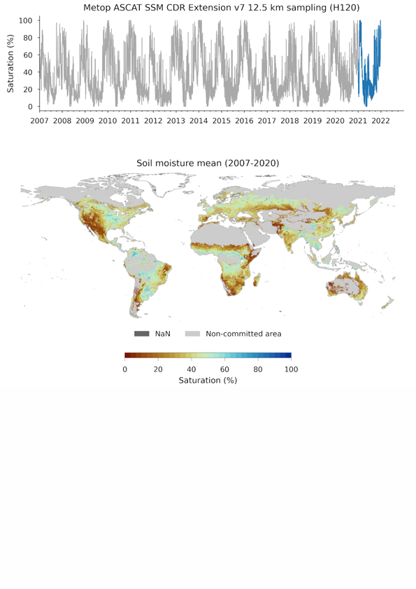 |
H120 ASCAT SSM CDR v7 EXT 12.5 km Metop ASCAT Surface Soil Moisture Climate Data Record v6 Extension 12.5 km sampling released
| ||||||||
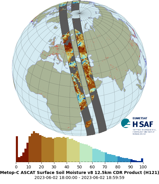 |
H121 ASCAT SSM CDR v8 12.5 km Metop ASCAT Surface Soil Moisture Climate Data Record v7 12.5 km sampling released
| ||||||||
 |
H129 ASCAT SSM CDR v1 6.25 km Metop ASCAT Surface Soil Moisture Data Record v1 6.25 km sampling released
| ||||||||
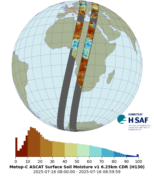 |
H130 ASCAT SSM CDR v1 EXT 6.25 km Metop ASCAT Surface Soil Moisture Data Record v1 Extension 6.25 km sampling released
| ||||||||
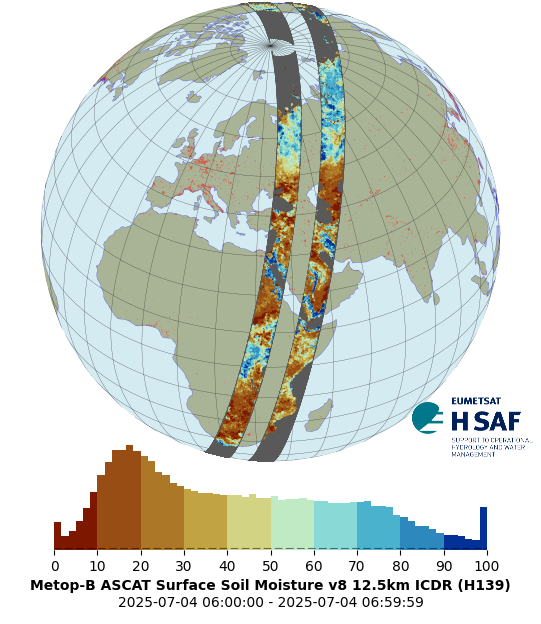 |
H139 ASCAT SSM CDR v8 EXT 12.5 km Metop ASCAT Surface Soil Moisture Climate Data Record v8 Extension 12.5 km sampling CDR-EXT released
| ||||||||
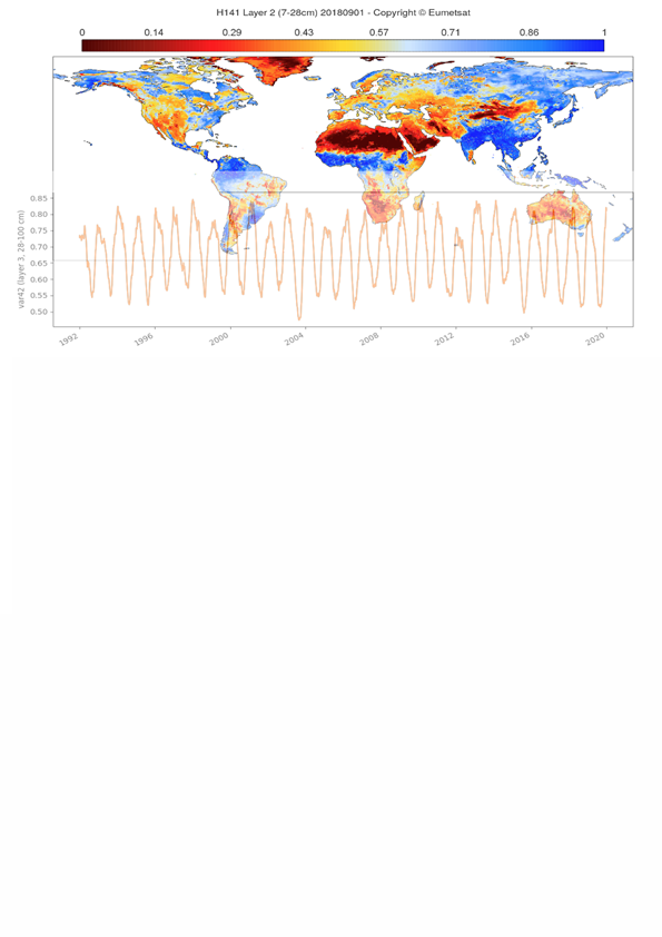 |
H141 RZSM-DR2019-10 Scatterometer Root Zone Soil Moisture (RZSM) Climate Data Record 10km resolution, based on ERS/SCAT, and Metop ASCAT assimilation, at 10km resolution, for 1992-2018 released
| ||||||||
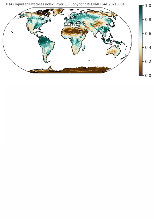 |
H142 RZSM-DR-EXT-10km Scatterometer Root Zone Soil Moisture (RZSM) Data Record 2019 extension, 10km resolution released
| ||||||||
 |
H145 ASCAT RZSM DR v3 0.1 deg Scatterometer Root Zone Soil Moisture Data Record v3 released
| ||||||||
 |
H146 ASCAT RZSM DR EXT v3 0.1 deg The Scatterometer Root Zone Soil Moisture Data Record v3 Extension, released
| ||||||||
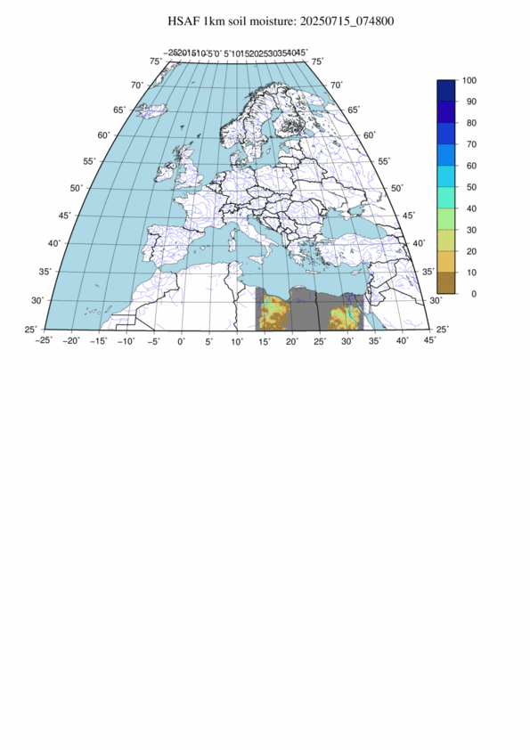 |
H08 SSM ASCAT NRT DIS 0.5 km Disaggregated Metop ASCAT NRT SSM at 1 km NRT superseded
| ||||||||
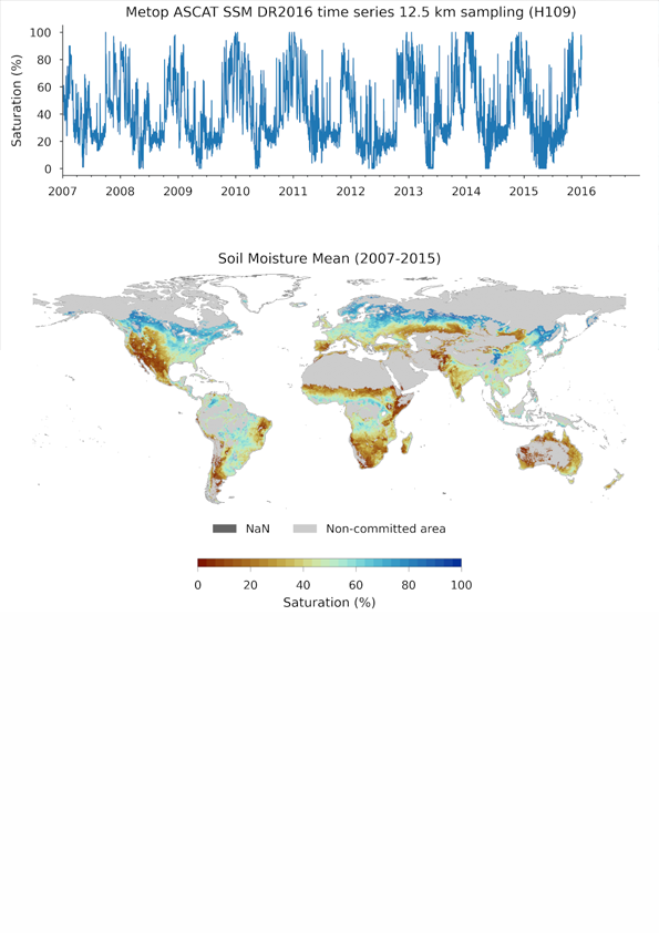 |
H109 SSM-ASCAT-DR2016-TS12.5 superseded
| ||||||||
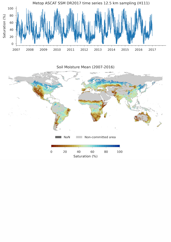 |
H111 SSM-ASCAT-DR2017-TS12.5 superseded
| ||||||||
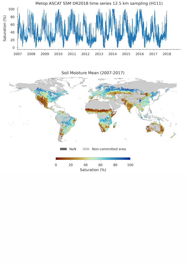 |
H113 SM-ASCAT-DR2018-TS12.5 superseded
| ||||||||
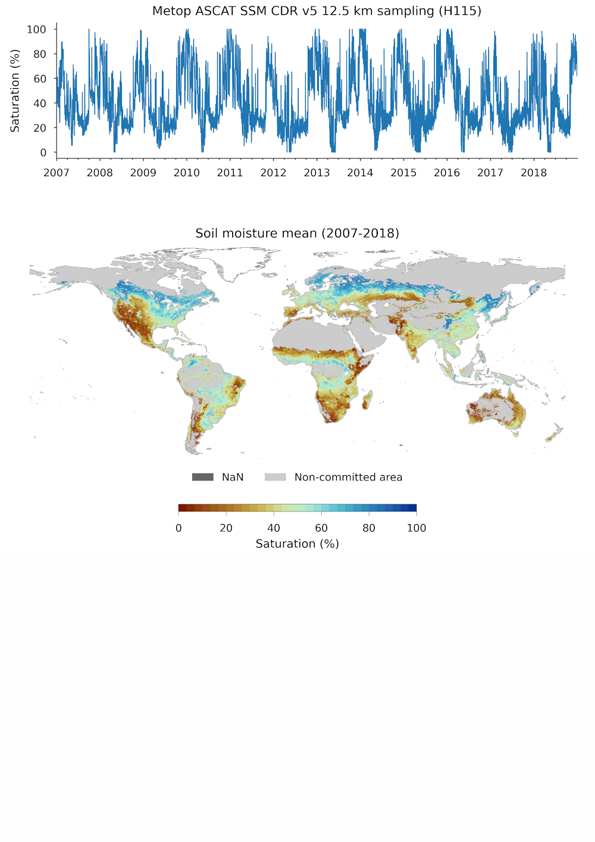 |
H115 ASCAT SSM CDR v5 12.5 km superseded
| ||||||||
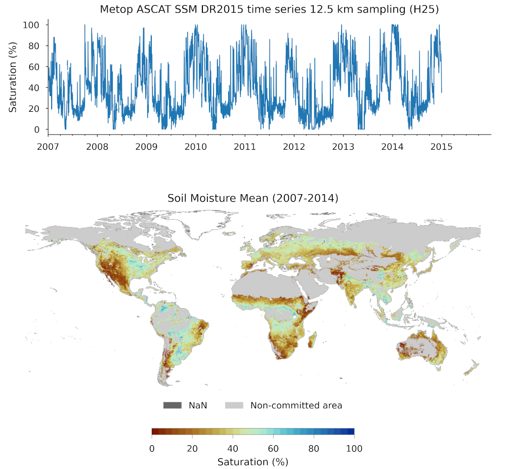 |
H25 SM-ASCAT-DR2015-TS12.5 superseded
| ||||||||
|
H27 SM-DAS-3 superseded
|